Osakarov District (Osakarovka Aūdany)
Osakarov District (Осакаров ауданы, Osakarov audany) is a district of Karaganda Region in central Kazakhstan. The administrative center of the district is the settlement of Osakarovka. The district had a population of 31,243 as of 2019.
The name of the district comes from the "Аса қарлы" (a lot of snow), because of the natural features of the district. Lake Shybyndy is located in the district.
During the industrialization of the Soviet Union in the 1930s, the central regions of the Kazakh SSR developed large coal and metallurgic industries, as well as large collective farms. On December 28, 1940, the Supreme Soviet of the Kazakh SSR passed a decree creating the Osakarov District. At the time of the decree, the newly formed Osakarov District comprised nearly 40 collective farms and a handful of villages. These farms largely grew various cereals, but were also home to cattle, sheep, horses, pigs, and poultry farming. Upon the outbreak of World War II, over 6,000 people in the district went to fight on the Eastern Front, 7 female Komsomol brigades took up work in their absence, and the district's furniture and record factory were converted into producing various equipment parts and linens for the front line effort. As part of the Virgin Lands campaign, a number of new farms were formed in the district during the 1950s and 1960s.
In 1993, 2002, and 2004, a number of villages in the district were had their names changed from Russian-derived names to Kazakh-derived names.
Map - Osakarov District (Osakarovka Aūdany)
Map
Country - Kazakhstan
 |
 |
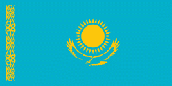
| Flag of Kazakhstan | |
The country dominates Central Asia economically and politically, generating 60 percent of the region's GDP, primarily through its oil and gas industry; it also has vast mineral resources. Officially, it is a democratic, secular, unitary, constitutional republic with a diverse cultural heritage, and has the highest Human Development Index ranking in the region. Kazakhstan is a member state of the United Nations, World Trade Organization, Commonwealth of Independent States, Shanghai Cooperation Organisation, Eurasian Economic Union, Collective Security Treaty Organization, Organization for Security and Cooperation in Europe, Organization of Islamic Cooperation, Organization of Turkic States, and International Organization of Turkic Culture.
Currency / Language
| ISO | Currency | Symbol | Significant figures |
|---|---|---|---|
| KZT | Kazakhstani tenge | ₸ | 2 |
| ISO | Language |
|---|---|
| KK | Kazakh language |
| RU | Russian language |


